You are currently browsing the monthly archive for July 2011.
This post is the first in an occasional series on the coal industry in Brymbo.
As I’ve previously mentioned, Brymbo’s first appearances in the records are often in connection with coal – as with the 16th century account of Leland, who in passing mentions “se-coles at Harwood”. Later, the township was for a time the epicentre of mining activity in the Denbighshire coalfield. It was then the most important and productive mining area in North Wales, and hundreds of men worked there underground (in appalling conditions, for the most part). The very intensity, and the early commencement, of this activity meant that by the early 20th century, many of the mines had been worked out. Even so, there were enough coal reserves left that the period after the Second World War saw a series of opencast workings that further scarred the landscape.

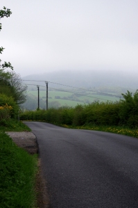
Looking down the lane from Mount Sion, Brymbo, towards Glascoed in the middle distance and the higher ground of Pen-Llan-y-gwr beyond
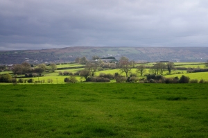
The area known as the Glascoed lies between the Nant-y-ffrith stream in the north and the steep, wooded valley of another stream in the south, sometimes known as the Cefn Brook. The land slopes downwards to the north-east, towards Ffrith and the River Cegidog. Crossed only by one or two narrow, winding lanes, it is today perhaps the quietest and most isolated area of the old township of Brymbo. Palmer, who translated Glascoed as “greenwood” (glas is often translated as “blue” in modern Welsh) commented that few people from Wrexham then knew how beautiful this out-of-the-way place was, “especially after a spell of drought“. This is still true, though to some degree this rural feel is deceptive as Glascoed’s past history includes mining and other industrial activity, much like the rest of the area.
Between the ravines of the Nant-y-ffrith and the Cefn Brook, the land forms a sloping ridge that leads upwards and westwards towards Cefn Farm, whose name translates as “ridge”, appropriately enough, and towards Cefn Buchan. Further uphill is the Waen, and eventually the Gorse farm and Bwlchgwyn. In the later 18th century these farms were purchased by John Wilkinson as he added to the original Brymbo estate, but prior to this much of the land around them seems to have been common. There are two roads crossing it; the Cefn Road, running along the ridge itself, and the “Glascoed Road” on the edge of the Nant-y-ffrith valley, but there is supposed to have been a Roman trackway here too, leading up from Ffrith: the Glascoed Road may follow its alignment. Despite this, archaeological investigations have had trouble proving the road’s exact route. Later still there was a packhorse trail on roughly the same alignment, and in the 17th and 18th centuries the Waen farmhouse was a stopping point for pack trains heading for the markets of England.
During the 19th century, the expanding village of Brymbo – or Harwood, as it was still sometimes known – became the centre of a new parish, which corresponded closely to the boundaries of the old township. A new church was built in the village, though it soon began to fall down (for reasons which no-one seemed to be able to agree on), and was replaced by another church on a different site. However, until the 1830s, and the dramatic rise in the area’s population associated with the development of mining and ironworking, Brymbo had no church of its own – as regards the established Church, in any case.
The picture is complicated by the fact that from the Civil War period onward many residents of the Wrexham area were Nonconformist, meeting in private rooms or other temporary locations. The Lewis family of the Vron Farm, for example, were amongst those who were associated with Wrexham’s Nonconformist circles, while up in the Glascoed the ffennah family had been keeping the Baptist cause active since the mid 1700s at least. Visible evidence of this did not appear until, again, the 19th century, when chapels began to be opened in the wake of the Methodist revival that swept through Wales in the later part of the 18th century, bringing with it a strengthening of other branches of Nonconformism. One of the first of these in Brymbo proper was a small Independent congregation that met on the old Powell estate, the Gyfynys. By 1808 it had gained a charismatic and eloquent preacher in William Williams, the son of a Merioneth carpenter, and steadily began to gain prominence as Welsh-speakers joined churches very different from those of their English-speaking landlords.
Trying to establish the ownership history of a piece of land can often drag you into other areas, such as the equally convoluted worlds of genealogy and family history.
I’ve previously written about Plas Mostyn, once the largest house of the township of Brymbo, as well as about its owner William Mostyn, Archdeacon of Bangor and serial marrier of heiresses. I’ve also written about the house’s later history. Most of the credit has to be given to Alfred Palmer, who also related its history in his various books about Wrexham. Palmer states that Mostyn himself bought the estate from a man called William Santhey in about 1640: strangely, William Santhey crops up nowhere else that I can find, though he does have the surname of a landowning family who once lived in the Gresford area. Perhaps he existed, and like many once wealthy and substantial people has simply vanished from the records, but perhaps not.
Bwlchgwyn is the ‘second’ village of the old township of Brymbo. It is supposed to be the highest village in Wales, and whether this is true or not, it certainly has some of the finest views, facing eastwards towards the flatlands of the Maelor and Cheshire and with its back to the fierce weather blowing over the hills.
As a settlement, in the modern sense, it is no older than Brymbo village itself and possibly much less so (though the moorland farm called Craig-Corn appears well back in the 18th century, when the Foulkes family tenanted it). One of the township’s main commons once surrounded the site of Bwlchgwyn, and it seems quite possible that like many such villages, it may have grown around small cottages and holdings encroaching onto the common land. Palmer suggests that the old one-night house custom was in operation in the area; if this was really the case, it is likely that the quarrymen and miners of the township would have carved small plots out of the common. According to Palmer, it also seems possible that this was the area of the township where its inhabitants cut turves, the common turbary: the name “the Gorse”, applied the nearby farm which was created out of common land by John Wilkinson in the late 18th century, may indicate this.


